
looking to regenerate the topography surface in InfraWorks from a DWG file to achieve higher accuracy, any tips ?
BIM Help Center Latest Questions

Hey forum members, I’m looking for feedback on the Artec Leo 3D Scanner. Whether you’ve used it recently or in the past, I’m interested in hearing about your experiences with its performance, ease of use, and overall capabilities. Any insights ...
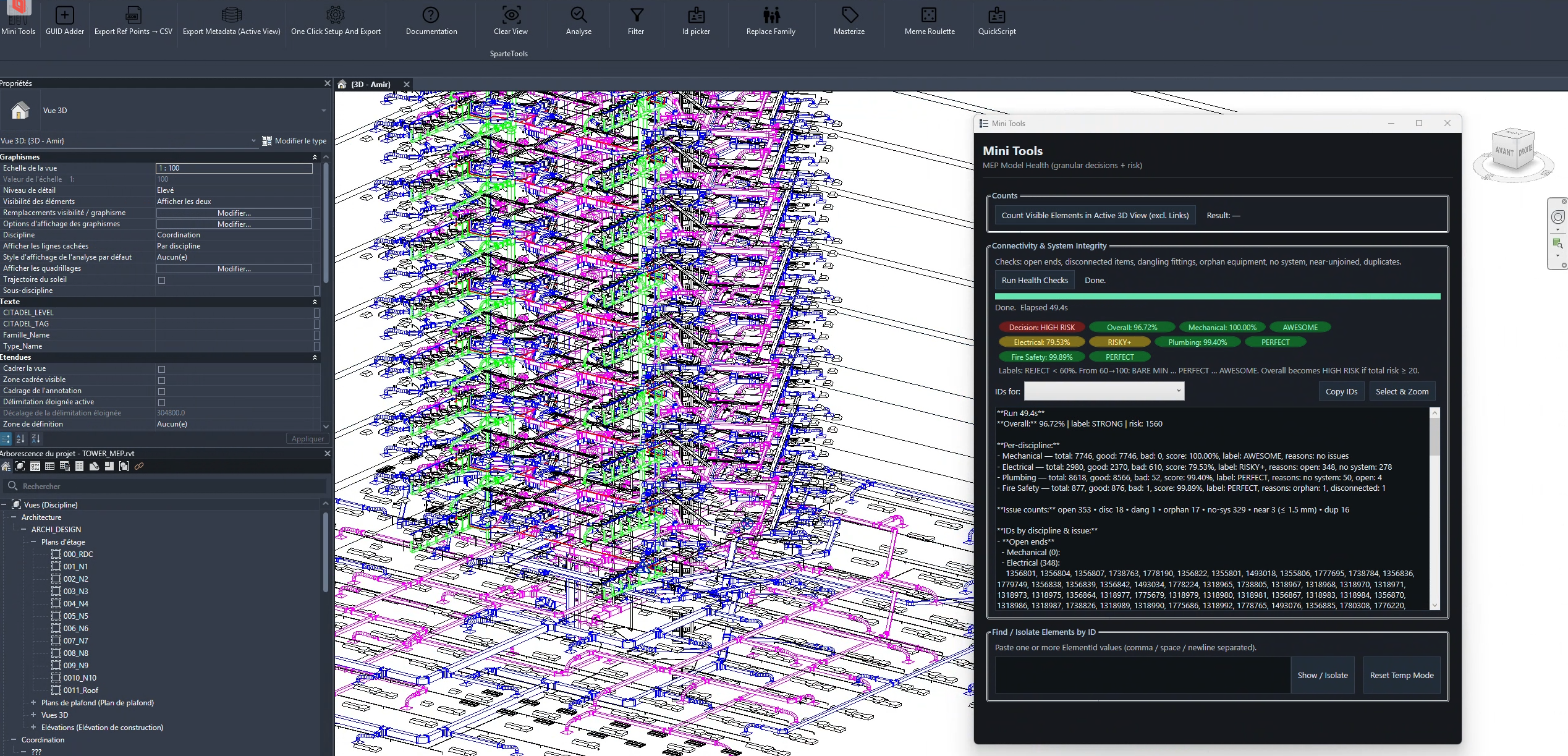
while reviewing different revit mep models, I keep noticing the same types of modeling issues appearing again and again. some of the most common ones: • open connectors / open pipe or duct ends sometimes pipes or ducts are ...
How can I export Revit rooms, spaces, zones to the FBX format ?
Hi everyone, I’m currently working on a project in Revit that involves handling a large point cloud, and I could use some guidance. How do you efficiently organize heavy point clouds in Revit? Any tips or straightforward workflows you can recommend? Thanks
What are the key concepts and techniques involved in managing and working with Revit coordinates, and how do they impact the overall design and collaboration process in building projects ?!
How can I stream a point cloud in Revit for optimal performance?