
Could you please provide recommendations for 3D laser scanning software tailored to specific needs, such as architectural design, industrial applications, or archaeological projects? I am keen to understand the software that excels in each area and the features that cater ...
BIM Help Center Latest Questions
I’m trying to export a georeferenced topo surface directly from InfraWorks to Navisworks, but when I import it, the model doesn’t retain its georeference. Has anyone else encountered this issue?
I’m looking to add or change parameters on objects in an IFC file, but I’d like to avoid using Dynamo. Are there other tools or straightforward ways to do this ? Thanks!
I have been using FARO scanners for my projects, but I now need to scan a large area and am considering NavVis scanners. Can anyone provide information on the quality of the point clouds produced by NavVis? Furthermore, I would ...
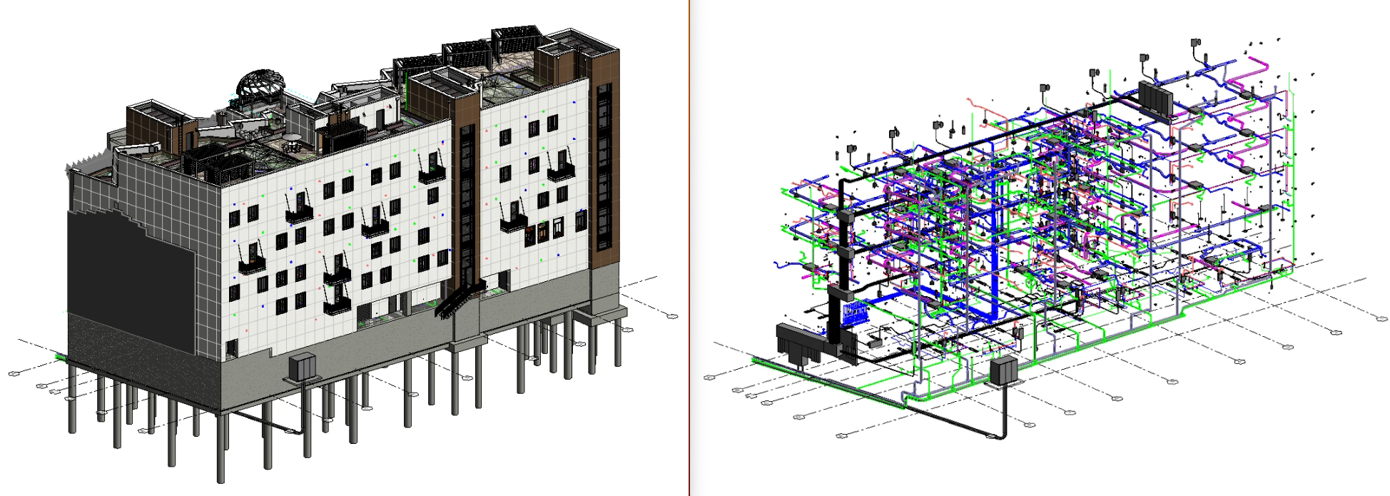
I’m looking for best practices to manage and structure MEP systems in Revit, including: System Navigator, classification, types, naming conventions, and abbreviations. Connectors, system connections, and classification segments. Discipline-specific hierarchy for MEP systems (e.g., HVAC, Plumbing, Electrical) in compliance with ISO standards. Ensuring ...
What is the process for creating a shared parameter in Revit using data from an Excel spreadsheet ?
I’m seeking guidance on creating a Revit topography from point cloud data while maintaining high accuracy. Can anyone share techniques, best practices, or recommended workflows for achieving precise topography representations in Revit?