
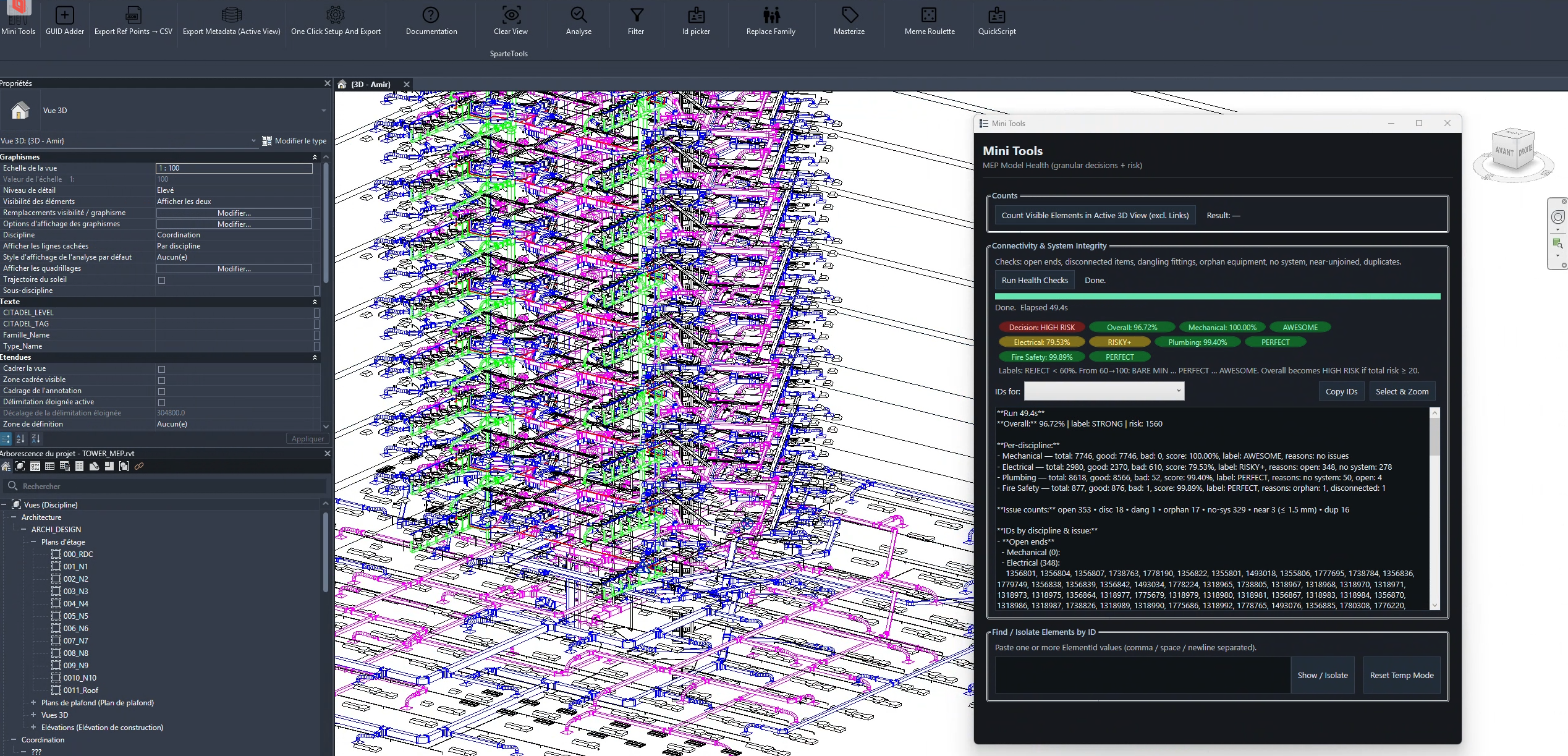
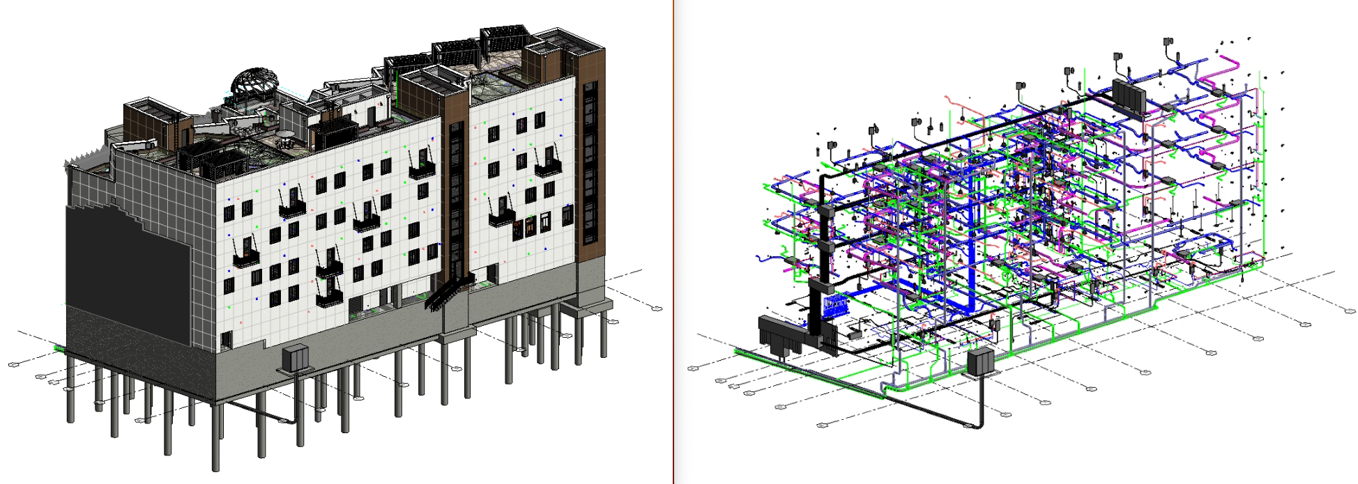
while reviewing different revit mep models, I keep noticing the same types of modeling issues appearing again and again. some of the most common ones: • open connectors / open pipe or duct ends sometimes pipes or ducts are ...
Sign Up to our social questions and Answers Engine to ask questions, answer people’s questions, and connect with other people.
Login to our social questions & Answers Engine to ask questions answer people’s questions & connect with other people.
Lost your password? Please enter your email address. You will receive a link and will create a new password via email.
Please briefly explain why you feel this question should be reported.
Please briefly explain why you feel this answer should be reported.
Please briefly explain why you feel this user should be reported.
while reviewing different revit mep models, I keep noticing the same types of modeling issues appearing again and again. some of the most common ones: • open connectors / open pipe or duct ends sometimes pipes or ducts are ...
I’m running into an issue where metadata isn’t being exported when using the Datasmith export via the Twinmotion plugin in Revit. I’ve tested this across multiple versions of Revit (2024, 2025, and 2026). In each case, I added custom ...
Tips on using Dynamo to reconstruct BIM elements ???
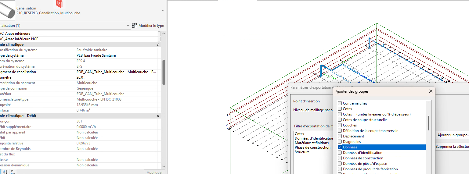
I’m looking for best practices to manage and structure MEP systems in Revit, including: System Navigator, classification, types, naming conventions, and abbreviations. Connectors, system connections, and classification segments. Discipline-specific hierarchy for MEP systems (e.g., HVAC, Plumbing, Electrical) in compliance with ISO standards. Ensuring ...
I’m trying to export my multi-discipline Revit project to the Datasmith format for use in Unreal Engine. The project includes multiple heavy Revit models that are linked together. What is the best workflow to export these projects while maintaining ...
looking to regenerate the topography surface in InfraWorks from a DWG file to achieve higher accuracy, any tips ?
I have a heavy DWG file in AutoCAD, and I need to clean it up quickly so it’s ready to import into Revit. What’s the best way to do this efficiently ???
I’m looking to add or change parameters on objects in an IFC file, but I’d like to avoid using Dynamo. Are there other tools or straightforward ways to do this ? Thanks!
Best methods to extract high-accuracy contour lines ?